Monday, June 30, 2008

Top 4 Fuel-Hardy Road Trips Still Worth Your Gas Investment

Regardless of gas prices topping $4.25 per gallon in some spots, I've already argued that folks are still packing their gear, their kids, their music, their kids, and hitting road. Here is my top 4 list of utterly jaw-dropping scenery and adventure to be had well worth the gas dime:


Yellowstone National Park is more than you imagined. Visitors should allow multiple days to explore this national wonder. No guidebook, school teacher, encyclopedia or Flickr photo album can convey the immensity and geologic phenomenon collected in the space of this park. I never would have thought I could be so intrigued by hot water spewing from the earth or the sight of a bison plodding within feet of our car. Here it is--the nation's first national park, a real gem: go hiking, drive it from stem to stern, explore the gateway towns, try fly fishing, camp, raft, take pictures, study the geology...soak up every second of it. Don't miss the dramatic snow capped Grand Tetons.


The California Big Sur Coast Highway is historic Route 1 and hugs every notch along the California coast. This is a dramatic and really pleasurable drive that runs between Monterrey and Ragged Point, about 250 miles north of Los Angeles. The landscape curves around steep coastal mountains, and from the road visitors have sweeping views of ocean, rocky coast and uplifted mountain faces. Before setting alogn this stretch of highway make sure you gas up--there is little of commerce along the Big Sur Highway.

The highway between Ragged Point and Los Angeles is worth it as well--the drive becomes a spectacle for fame. You'll pass right through Santa Monica, past Malibu mansions and straight through Beverly Hills--just a left turn in the middle of town and you're on historic and romantic Rodeo Drive.


The drive through the South Dakota Black Hills and the Badlands, the western half of interstate 90 in SD is an unexpected visual surprise. I've done an extensive post on this trip. All I have to say is do it. Plan on staying in the area for a day or two, visit Mount Rushmore and stop by Crazy Horse. Lodging options are plentiful and diverse. We stayed a night in a cute one room log cabin, all modern amenities and plenty of room for a small family.

Route 66, any segment of it is a slice of Americana. This strip of roadway traverses hundreds of miles between Chicago and Santa Monica, California. In between are cities like Tucumcari, Oklahoma City (don't miss the Oklahoma City bombing memorial-extremely beautiful and moving at night), Albuquerque and Flagstaff, Amarillo, and Tulsa, not in any particular order. The roadside is punctuated with kitschy 50s motels, greasy spoons that still serve some of the best travel food in America, and large swaths of landscape between map points.

Bizarre Travel Links

I was visiting Digg recently and I stumbled across a few really unique travel articles. Consider these some of the more innovative and outstanding road trip ideas:

  • Road tripping hobby musicians-- leave your spendy guitar at home and invest in a travel guitar that can take the hard-knocks and environmental abuse on the road.
  • I'm not Jewish, but if I were maybe I'd be interested in Kosher Travel. How 'bout Kosher road trips?
  • As a kid I was fascinated, no, obsessed with the notion of time travel. I stuffed a dogeared copy of Wells' The Time Machine into my bike bag, my jacket pocket, my school lunch box--pretty much wherever I went. In fact I wanted to be the first girl time machine inventor. Article about the feasibility of time travel that brought my childhood wonder rushing right back in...I'm off to make a blueprint....hee hee, ha, ha.
So there's your time travel kosher vacation, and don't forget the rugged travel guitar for those bumpy blackholes.

Fuel-Hardy Travel

Gas prices not near their tipping-point for certain road trip vacation journeys.

During the 7 days we stayed in West Yellowstone, MT we criss-crossed Yellowstone National Park over and over. Meanwhile, in gateway towns surrounding this vast park, gas prices topped $4.25 a gallon. I imagined those prices would be a real summer vacation show-stopper. The media reports have certainly indicated that consumers at large have all but parked their cars and cancelled long-distance road trips and other fuel-hardy vacations. But according to the steady stream of family cars and RVs everywhere in Yellowstone I have to conclude somewhere there's skewed statistics.

In West Yellowstone the gas station operators I asked reported banner summer volume regardless of pump price. 'K..... a thing that makes you go hmmmmm.

See I think we've vastly underestimated the American desire to hit the road--$4.25 per gallon is not the tipping-point in every travel circumstance. So what is it? The point at which there is a significant brake put on the travel plans? I considered my fuel tipping point...would I curtail road trips at $5.00 a gallon for gas? Probably, in fact had I not been driving through some of the most spectacular areas of America I would have saved my cash, already.

That's it! It's easy for bi-coastal journalists to report travel curtailed in areas around the East Coast megalopolis and in California --although I'd argue vehicle travelers have probably continued to charge up and down the Big Sur highway--highway 101 that twists and turns with every mountain fold along the California coast--that's a spectacular fuel-hardy drive, my friends. And so is a trip to Yellowstone National Park and the Grand Tetons. So-so vacation destinations may show a measured decline in traffic flow, but I'm willing to bet that the spectacular, once in a lifetime drives are still worth $4.25 a gallon.

**Hit the road and make the most of every single minute you have on gas-time...keep a travel log, stop to check out every site you can, take pictures of your travels, save gas on the scenic byways and backroads, but most of all relax, turn off the kids' DVD player, and open your eyes, man.

Thursday, June 19, 2008

On the Road Observations

Just some things I noticed between West Yellowstone MT and Baker City, OR


  • Fedex, UPS and ABT are all driving long loads out here: three trailers hitched to a cab. I thought it was to save gas, but probably not that much with the extra load. Add together the combined volume of goods delivered, plus the little cost savings in fuel and these companies may be doing all they can to save.

  • Idaho and Montana post 75 mile per hour speed limits-- like boon days for gas. But limits like these are hardly cost-effective. At 7o or over you can literally watch the gas gauge drop.

  • Each state's deer signs are slightly different: some are chubby, some are skinny and I saw one today in Oregon that displayed this: DEER. That pretty much says it.

  • Lexus is transporting some special cars in black, covered trailers? Two big rigs heading my way and two more I spotted heading in the opposite direction at one point. Top secret performance vehicles?

  • McDonald's coffee is better than I expected, but is an excellent example of market value--it goes for nearly the same as any specialty coffeehouse.

Yellowstone to Portland Oregon

Left West Yellowstone Montana, gateway to the west entrance of Yellowstone, at 8:30 a.m. Headed south on 20 toward Idaho Falls where we picked up 15-86-84. West of Pocatello the highway turns exclusively to 84. South 20 travels through a wide flat valley to the east the Grand Tetons, to the west in the distance are the Pioneer Mountains. Gas is $4.23—a small fortune to fill up an SUV, what we’re driving and loaded to the max, at that.

Speed limit through Idaho is 75—great if you have time to make, horrible if you’re concerned over your gas gauge. At 75 you can literally watch the gauge moving. Out here a few of the major trucking companies are stringing together three trailers (long loads), perhaps to save fuel (does this trick work?) or to simply move more product at once. The most common long loads are FedEx and UPS—interesting, too they have added on a fuel fee to their shipping services.

Spent the night in Baker City, Oregon, not far over the Oregon-Idaho border (the time changes to PST). This is Powder River and Hells Canyon land. Baker City is a small town and wireless coverage is poor. The Best Western is pet friendly—a key for us. The hotel restaurant is just okay, basically like the standard diner food you find anywhere, so disregard the “fine dining” sign tag. Not fine dining and our waitress seemed harried and inattentive. In the distance the Glass Mountains tower snow-capped.

The next morning was sunny and surprisingly warm. Interstate 84 swings northwest until it meets the Columbia River at the uppermost Oregon border.

A few memorable roadside sights:

Greenwood Tree Farm—miles and miles of a tree species planted along the westbound shoulder.
Roadside native plants—grayish green tea olives, Artemisia/sage brush, yellow and white wildflowers.

The Oregon Trail turns into the Lewis and Clark Trail—I try to imagine seeing this land for the first time as explorers may have.

Between Pendleton and Boardman the roadside is brown and dusty, uninspiring. Beyond Boardman the highway swings alongside the Columbia. The territory is still brown, but much hillier and rockier. At this point Mt Hood becomes visible in the hazy distance and almost seems like an apparition, some surreal snowy volcano. Speed limit in Oregon is 65 and cops seem quite committed to it.

Groups of wind turbines sit on windy ridges above the Columbia at exit 137 for Arlington.

The closer we draw to Portland the higher the hills rise alongside the roadway, bluff-like and slightly greener.

Two dams are located along the Columbia in Oregon:

John Jay Dam
Dalles Lock and Dam

Both are quite impressive.

Bluffs slope down like giant’s feet with tan toes that sit right at the rivers edge.

Mount Hood rises 11,000 and is unlike anything else in the region. The Columbia River Gorge area is lush. The river itself is wide and brown; tugboats and barges float along and there is an occasional riverside grain elevator.

The Gorge area is also home to a collection of wineries, many that you can see across the river on the Washington side. Lodging includes dingy motels and upscale inns like the Columbia Gorge Inn.

Hood River area

Multnomah Falls—are located yards from highway 84 not far east of Portland. Take the exit to the left and park in one of the visitor lots. A walkway leads right up to the bottom of the falls. Multnomah Falls is one of the most spectacular waterfall sights, period; well worth the stop.

If you can’t find the time to pause for a look you actually can see a large part of the falls from 84.

Wednesday, June 18, 2008

Fly Fishing Yellowstone

Today was great--spent over 8 hours learning how to fly fish in Yellowstone National Park. This area is one of the most popular for flyfishing and the park is loaded with fantastic rivers to fish. Our guide took us to Firehole River today--it's an early season river with a variety of "holes" worth fishing.

We spent the first couple hours learning a number of casting techniques before we hit the river. Both of us landed 3 trout apiece--3 rainbow trout for me and 3 brown trout for her. This is catch and release inside the park.

I used a dry fly most of the day and had the opportunity to practice casting into slow moving deep currents as well as heavy shallow currents. We learned how to work an area of the river, use the water, land and air around us to determine current hatches and insect activity, and in which parts of a river the fish are best found.

Caddis and nymph flies

Getting Around Yellowstone: Maps and Guides

Use special Yellowstone National Park maps and resources for your vacation.

When you enter Yellowstone the ranger at the entrance will give you a basic park map. We've gone through two--worn the first out with all the folding and unfolding. It gives you the essential roadway and attractions throughout the park and on the back you'll find short summaries of the three general areas of the park as well as the types of animals and plants you might encounter and some general rules and regulations.

But so much of the park is located off road along trails that you may want to invest in a more comprehensive park guidebook and a Yellowstone hiking and trails guide. You can purchase good guide books at the visitors centers located in a number of areas in the park. The Canyon Village Visitors Center is very well stocked with resources and staff are very knowledgeable.

Tuesday, June 17, 2008

Beartooth Highway--Just Beyond Yellowstone

Beartooth Highway From Yellowstone National Park to Red Lodge, Montana

Before I landed in Yellowstone I had no idea that a Beartooth Highway existed much less that it was once dubbed the number one most scenic 50-something miles in the U.S. So said Teddy Roosevelt whom Time Magazine once listed among one of the most influential people in history.

Since we've been here the Beartooth has been closed all the way to Red Lodge, but it finally opened yesterday, so today about midday we headed again in that direction--West Yellowstone to Cooke City where Beartooth (highway 212) runs east in a squiggly mountain top line to Red Lodge, Montana.

Beartooth Highway: Hairpins and Deep Ravines

From Cooke City Beartooth heads into hilly territory marked heavily with a variety of vegetation: conifers, aspen, grasses and gray/green sagebrush. Glacial boulders, small to huge, also punctuate the landscape. About halfway between Cooke City and Red Lodge Beartooth winds like a paperclip upward until you're skimming the very ridge of the Beartooth Mountain range in Shoshone National Forest and dancing between the Wyoming and Montana borders.

At this time of year the region is still under snow. Vertical snow-walls, some as high as 12 feet, define the roadway. At the very top of the ridge, we stopped at the Montana-Wyoming border and built a snowman.

I'd not say that Beartooth is the most beautiful ribbon of roadway--it's certainly dramatic and gives you a serious altitude rush, but the snow cover really obliterates much of the features and the white has turned dingy and old. There are a number of lakes marked along the way that remain covered and hidden and what mountainside is exposed from snowmelt is brown and rocky. But the canyons are deep and dangerous, the hairpin curves sans guardrails.

Dinner in Red Lodge, Montana

We entered Red Lodge about 6 pm and were craving a steak dinner. Broadway Avenue is the main street through town. It's quaint and lined with a variety of shops, saloons and restaurants. We had dinner at the Pollard Hotel. The chef designs seasonal menus that change weekly, many of the ingredients sourced locally. Our dinner picks included Zac's salad of the day--field greens dressed with kumquats, shaved carrots, lump crabmeat, wonton strips, and lemon vinaigrette; a beef tenderloin with morelle mushrooms and a tomato aioli; and tabasco fried chicken breast over garlic mashed potatoes and lightly sweetened carrots and fennel. For dessert we chose the apple crisp with blueberry tequila ice cream: Cost: $75. Very good. Fried chicken dinner and the apple crisp dessert--highly recommended.

We stopped in at the Montana Candy Emporium for a few pieces of handmade chocolates. This store is a virtual cornucopia of almost every kind of candy you can imagine and besides the fresh fudges, truffles and creams, most of your favorite childhood "penny" candies are accounted for.

Driving Yellowstone at Night

The trip back we headed east out of Red Lodge along highway 308 and picked up highway 72/120 south toward Cody. A few miles north of Cody we headed west on 296 or Chief Joseph Scenic Highway, a 60 mile stretch of roadway that joins 212 just north of Cooke City. The evening stayed light until well past 9 pm with a nearly full moon rising. A worthwhile drive.

Back in Yellowstone we made slow headway in teh dark. Wildlife on the roadway without warnign are a real danger. We came upon three elk in various locations on the road, one a mother with a new baby stumbling along at her side. Teh park speed limit is 45, but we kept it to about 40.

Yellowstone by night is a completely unique experience from day. The raods are virtually deserted--we passed maybe a handful of cars the entire way. But animals are active. The light from the nearly full moon ignited the rivers as we drove past. Steam from geysers glowed like paranormal apparitions in the caldera region. We were tired and ready to get back to the hotel, but this was really a treat.

Yellowstone Lodging

We've had a chance to see a lot of types of accommodations along the way. Types of Yellowstone lodging available:

  • Campgrounds inside the park and outside offer RV, tent sites and rustic cabins. Remote camping is available upon permission and a small fee.
  • Park lodges include the historic Old Faithful Inn, Snow Lodge, and a number of others in various locations aroudn teh park. You'll also find modern cabins for rent.
  • Ample accommodations exist in Yellowstone's gateway cities/towns. Here in West Yellowstone visitors may opt for a range of low-budget to mid-range hotels (we're in a Best Western), small rental cabins and campgrounds like KOA. In Cooke City you'll find rental cabins and log homes along with small motels. Most accommodations are not considered in peak season, so costs are up.
Anyone interested in driving Beartooth Highway from Yellowstone to Red Lodge and back should allow a full day, 8 hours or more.

Sunday, June 15, 2008

Yellowstone Geyser Road Trip


Geysers, Mud Holes and Steam Vents of the Yellowstone National Park Caldera Region

Today we saw most of the Yellowstone geysers. Thermal activity is largely confined to the western portion of Yellowstone in what is known as the Yellowstone Caldera. Old Faithful is the most notorious and sought-after geyser in the park, but there are literally dozens of active and unique geysers. Most of the geysers accompany various other types of interesting thermal features, including fumaroles, mud pots, and steam vents.

Lower Geyser Basin Yellowstone

Lower Geyser Basin I found the most entertaining of all. Here a boardwalk winds throughout a very active thermal area. Boardwalks are a logistical must to get visitors close to the features. The surrounding ground is covered in mud flats, boiling mud cauldrons and steamy geysers in all shapes and sizes. The attraction features a number of bubbling mud craters and pools and crystal blue steam vents. And the area is anything but quiet--the thermal features here bubble, seethe and hiss with steam and boiling water.

Follow the boardwalk around to a group of various sizes and types of geysers, the most impressive and noisy--Fountain Geyser. Fountain spews powerful plumes of water probably 50 feet in the air and it is shrouded in billowy white and gray steam clouds. The spray is not hot--once it hits the air it is immediately cooled.

Just across the boardwalk is my favorite little geyser--"Jet." If this unimpressive mound of chunky lava rock is doing nothing when you happen on it--wait a few minutes, you won't be disappointed. Jet goes from silent to furiously spewing and spitting hot water out a half-dozen blow holes along its surface--it looks like a spoiled child throwing a hissy fit. The "eruption" lasts about 30 seconds before it goes silent again.

In this same area you'll see also Spasm and Clepsydra geysers.

Midway Geyser Basin Yellowstone

Midway Basin may be the most underrated of all, but the most visually beautiful. Here Excelsior Geyser pours hundreds of gallons of hot water into Firehole River. Excelsior has not erupted since 1985, but it could....The boardwalk in Midway Geyser Basin is long and constructed of indestructible composite boards--very handicap accessible. Follow the boardwalk past Excelsior and it winds around to pretty Prismatic Pool. Here a Caribbean blue and green pond is largely shrouded in gray, white and red steam, its coastline a fractal boundary between water and rust and white bacteria mats. When we arrived at Midway this morning we were just about 20 minutes ahead of the visitor rush. The entire attraction was very quiet and only a few visitors wandered around. Prismatic was so beautiful I could have pulled up a chair and sat their just mesmerized.

The last leg of the boardwalk meanders past Opal and Turquoise Pools.

Old Faithful

Old Faithful was great, but for me highly overrated. We sat waiting for the eruption for almost an hour and Old Faithful was late. I'm not much for crowds, but apparently this site gets many more in the height of the summer. I was much more interested in Old Faithful Inn--this is a huge, old lodgepole inn constructed back in the late 1800s. The construction is amazing, especially dramatic is the high lobby rough-hewn roof and beams.

Finished up the day covering the route from Old Faithful southeast to West Thumb. From there headed northeast to Lake Village and on to Canyon Village before heading back westward to Norris and West Yellowstone.

Saturday, June 14, 2008

Yellowstone, Northeast quadrant and Mammoth Hot Springs

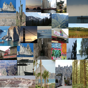
Northeast Tower Falls to Cooke City and Beartooth Highway--best drive in Yellowstone and Beyond

We headed out early this morning heading from West Yellowstone with intentions to drive through Northeast Yellowstone and the Beartooth Highway--by all accounts the single most scenic drive in America. Beartooth usually opens the beginning of June following the winter, but when we hit the Yellowstone entrance this a.m. we saw the signs for Beartooth closure, apparently a combination of a lot of snow and avalanches. But on the recommendation of a park ranger we opted to head that way anyway--he said he considered the northeast part of th epark the most beautiful and a bit less trafficked.

Headed out through Norris to Canyon Village. There we stopped at the Visitor Center. I am a total nerd when it comes to guidebooks and one of my faves was there: Roadside Geology of Wyoming, which includes all the geologic info on Tetons and Yellowstone. If you want a more detailed guide to the park's history, features, geology, etc--hit the Canyon Village Visitor Center. Great interpretive gifts for kids, too.

From Canyon Village we headed north to Tower-Roosevelt. We stopped to see Tower Falls. When we headed east from Tower-Roosevelt toward Cooke City the landscape turns alpine. This stretch of roadway is calendar-scenic. If you have been wondering where you can see the sprawling alpine meadows with snow-capped mountains rising in the background--this is where you'll find them, just look in every direction. The landscape is verdant, starting to color with wildflowers, and bison and elk are everywhere. The bison is my new favorite animal. This is just an impressive beast. Plenty of photo opps even for close-ups. In fact a few rangers drove a whole herd of bison with babies across a busy roadway yesterday evening. Amazing thing to witness.

By the time we reached Cooke City the elevation was much higher and still quite a layer of snow-cover in areas. We grabbed lunch in Cooke City at the Beartooth Grill. If I lived here I;d be a regular: dark lodgepole building, very rustic, good food and well over 100 kinds of microbrews. (Gas here was $4.25!) We turned around in Cooke City, our plan retrace our steps to Tower-Roosevelt and onto Mammoth Hot Springs before the end of the day.

In Tower-Roosevelt we turned west toward Mammoth, instead of south--the way we'd come. I'd only seen photos of Mammoth Hot Springs and I just learned that it was the discovery of this geologic phenomenon that was a key inspiration for the very creation of Yellowstone.

Yellowstone and Geysers

I had heard of Old Faithful before---yeah, yeah, yeah there's a geyser. I didn't know anything. This is the thing about Yellowstone and geysers: Old Faithful is just one of hundreds of geysers, hot springs and steam vents in Yellowstone. In places steam just sputters from the belly of the earth in boiling little sulphuric pools right alongside the road and there are a number of very notable geyser spots. But Mammoth hot springs is a destination, a must-do.

Our drive west from Roosevelt toward Mammoth was, um, hurried and thankfully not much traffic. All I'll say is if you need a bathroom in an emergency--there's one M/F restroom between Roosevelt and Mammoth. (It happens....what can I say?).

Mammoth Hot Springs--How Yellowstone Got its Start

We entered Mammoth from the east. Our first taste of Mammoth was elk lounging in the small town square. You are not supposed to approach them, but you have plenty of photo opps just passing by. In downtown Mammoth you'll find a general store stocked with all kinds of gifts for everyone you need to buy for, including an array of huckleberry food-stuffs--a regional favorite.

Mammoth Hot Springs rise like a huge whitish mound, not impressive from ground level, but you must follow the boardwalk up around the terraces. The sign at the bottom suggests visitors allow 2 hours, but you can see most of it in about an hour. We walked part of the way up and saw some spectacular crystalline formations, jutting out in natural terraces and icy-looking blocks. Hot springs are active in various areas. When we drove out of the area we continued heading west and then the road turns south. We rounded the back side of Mammoth up at the top of the hill--the first couple of turnouts offer spectacular vistas of the upper most terraces of Mammoth Hot Springs. From here you can easily view the nicest of the emerald green pools.

Mammoth Hot Springs in Yellowstone is a must-see for anyone with even the slightest interest in geology and natural phenomenon. Pick up a comprehensive Yellowstone guidebook that contains information about the geologic structures in the park, it's very helpful.

Yellowstone Animal Sightings and Traffic Jams

On the way back to the West Entrance we ran into a traffic jam for about an hour. This is another thing about the speed limit in Yellowstone--visitors will literally just stop in the middle of the road for a wildlife photo opp., so you can't fly along the roadway. This traffic jam was due to an apparent grizzly sighting. People were actually leaving their cars to run up ahead of traffic for a possible photo opp. Sorry, but I'm not leaving my car to approach a grizzly. It turned out to be an impossible sighting from the road, but it nevertheless tied up traffic for probably a few hours. Kind of ridiculous, but just an fyi about park travel in the busy summer. But seriously, anyone at any one point can stop pull out a camera and in most cases the very act draws a slew of curious passersby.

Our wildlife sightings for the day: bear cub up a tree (amazing sight), plenty of bison, wolf, elk, antelope and a huge crow.

Packing--if you're unaccustomed to this part of the country make sure to bring a variety of clothing. Even in mid-June the nights are cool and it can snow on just about any day of the year.

Friday, June 13, 2008

Wyoming, Tetons, and Yellowstone

Gas prices top $4.15 in Wyoming and still road travelers invest.

Left Boulder at 12:30 pm.
North on 25 to Cheyenne, WY.

80 West to 287 North. Terrain is beautiful--ranging from flat, high prairie to dark red sandstone cliffs and cathedral like bluffs just south of Dubois.

287 was nearly deserted, which was good. This is a two-lane highway with frequent passing opportunities, but even a little bit of traffic could make it dangerous.

Into Grand Tetons National Park we met snow--not on the roadways, but plenty on the ground and covering the trees. Caribou are numerous and wander in packs across the road--they are as big as moose.

This drive was longer than we expected--11 hours (from Boulder to West Yellowstone) with few stops. Be cautious traveling through Tetons and Yellowstone--speed limits are no more than 45 mph and cops are rigid, even at night.

A good place to grab a restaurant meal would be Dubois, WY--very quaint, obviously caters to travelers looking to soak themselves in rustic and woodsy. All the buildings have a very western, hewn log look without being cheap looking.

Best Western - Weston Inn in West Yellowstone, MT just blocks from the west entrance to Yellowstone (closest to Old Faithful). Three Best Westerns as soon as you drive into town all within a couple blocks. We checked prices--two others were markedly higher and not sure why.
We're spending $119 per night at the BW-Weston, with pets, deluxe free continental breakfast, free wireless, coffemaker, frig and microwave--very clean and non-smoking! The bargain of the three.

Current gas prices you'll find between Boulder Colorado and Yellowstone/Tetons in Wyoming.

  • Gas prices just north of Boulder: $3.87
  • Lander, WY- $4.14
  • Dubois, WY- $3.99
  • West Yellowstone, MT- $4.19

Just amazing on the prices. However, I'm skeptical about how many people have actually been turned off to road travel. Tetons was quite busy with travelers even at dusk--most with license plates from quite a distance away. Hard core travelers are still investing.