It's summer in Portland, which means the more sunshine the natives can soak up the better. After September the rain returns, first in fits and starts then in steady and predictable day-after-day patterns.
Living in a high rise apartment building -- Harrison Towers -- just a couple blocks from the waterfront and Riverplace. Street car stops right out front and we gave it a go last Saturday. It;s very user-friendly and compared to larger cities one of the simplest mass transit vehicles I've ever used. Fare for a day is $1.75, but that's only if you travel outside the "Fare-free Zone," a large chunk of the downtown route you can ride for free.
Every Saturday morning we walk norht on Harrison a few blocks to the Portand Farmers Market. It's better to go early, less congested.
We've checked out the Pearl District and Alphabet District around 21st and 23rd streets-- also quite boutiquey with plenty of restaurants, pubs and coffeeshops. On teh EAst Side we've trekked up and down Hawthorne and introduced ourselves to the Alberta 'hood, a Bohemian hold-out and a refreshing breath of air after a Saturday afternoon along the busy strip of Hawthorne.
I think the best coffee I've had in Portland, this visit or the last visit, was Stumptown Coffee. Per cup the spend is a bit more, but this local roaster boasts some of the finest beans collected from all over the world. At the Farmers Market you can grab a cup, french press or special drip roasts.
Willamette Week, a free newsprint publication, puts out an annual city guide--the Willamette Week Finder is a must-have and is available in many retail places. We've used it to find new restaurants as well as explore neighborhoods.
This coming weekend we'll head to the coast, Newport or Seaside. We've been to Cannon Beach a couple of times when we were here two years ago. Time to try a couple new beach spots.
Monday, July 14, 2008
Saturday, July 12, 2008
Streetwise Portland, Map Review
Streetwise maps are popular in most bookstores, they're laminated, folded and compact, so really appealing to travelers like us. HOWEVER....this is an inaccurate rendition of Portland streets: Streetwise Portland includes some street routes that don't exist and fails to show others that do exist. The map area is also very limited. My recommendation: go with the big clumsy fold out map for a more accurate trip about the city.
Streetwise Portland map--just say no.
Streetwise Portland map--just say no.
Looking for Good Pizza in Portland
I'm from Connecticut and I'll admit it, a pizza snob. I've eaten at Pepys Pizza and Modern Pizza, both in New Haven Ct and two of the best pizza places in the country. So I'm choosy.
Craving pizza this morning in a big way and on the West Coast. After reading a local guidebook decided to try Apizza Scholls tonight.
Located on the SE side of Portland at 4741 Hawthorne Blvd I had big expectations. Hours are 5 p.m. through 9:30 p.m. Get there early, the place was packed with easily an hour wait or so by 5:30. The place has limited seating area, thus the wait, plus it's apparently garnered a rep for good pizza pies.
We stood at the bar in the waiting area and enjoyed a glass of wine--makes the wait so much more bearable and when we were there the bar was clear. Lots of families and larger parties waiting for seats. We were seated ahead of quite a few parties because we were willing to take seats at the bar in the actual restaurant and there was only two of us.
Pizzas come in one size--large. My snooty review: pretty good for being clear across the country from really good NY pizza. Attention really paid to baking with high heat and making sure a goodly amount of char is put to the crust--really important when it comes to the serious craft of pizza baking.
Pizza could use a bit more mozz for me and parmesan cheese is meted out by the tablespoons and you have to ask for it. Sorry, but I come from a place where the parm is in jars on every table. Okay, so it costs money and this Portland restaurant boasts completely natural ingredients, which means parm is fresh and doesn't come in a jar that can sit at room temp,----still....
Overall, thumbs up on Apizza Scholls pies.
Red wine and beer on site, in limited quantities and they warn that they could run out of pizza dough on busy days....not sure how that could interrupt one's dinner plans, but....
Apizza Scholls
Portland Farmer’s Market, Oregon
The Portland Farmer’s Market is not to be confused with the “Saturday Market” along the Willamette riverfront. The Portland Farmers’ Market is set up on the main campus of Portland State University, smack dab in the middle of downtown, every Saturday morning from April through mid-December. In the realm of farmer’s markets this is an epic length of time and offers access to an impressive scope of seasonal and regional foods. Vendors are almost exclusively farmers and small agricultural producers from the region: the Columbia River Gorge and Hood River areas. There is a mix of organic and traditional, but all feature a luxurious spread of their earth-wares.
Come prepared to carry bags. Market veterans tote their own handled shopping baskets. You’ll find fresh artisan cheeses, rustic breads, sinfully delicious baked goods—try the pumpkin scones and pumpkin chocolate chip cookies. Fresh berries include regional favorites the huckleberries and marionberries, and fresh veggies include heirloom varieties of almost everything that springs from the soil. If you want exotic meat, shop for range-raised elk and buffalo. Crave seafood? Stroll the tents for fresh Dungeness crab, mussels and regional fish varieties. Vendors tug them up fresh from the depths of ice packs. Just walk nearby and I swear you can smell the sweetness of the Pacific Ocean. As compliment to your baked bread don’t miss the homemade preserves and for your veggies and meat there are fresh and unique marinades and artisan rubs, custom-blended and artfully packaged. Brave a taste if you’re unsure.
Don’t leave without an armload of fresh-cut flowers, either. The only other place I’ve seen fresh bouquets this inexpensive and luscious was at Pike’s Place Market in Seattle. Bouquets are built from a foundation of plump dahlias, to which are added generous stalks of daisies, husky sunflowers, cosmos, even globe thistle. Smaller bunches start at $8 and go up from there. If there is a special combination of blossoms or colors you’d like it’s possible the vendor will hand-pick you a custom bouquet on-the-fly.
My favorite finds have been the sweet, red curry squash, pumpkin chocolate chip cookies, extra sharp cheddar cheese, fresh raspberries, and heirloom tomatoes of any kind.
If you are parking nearby don’t forget to pay the parking kiosk – they are located in various spots along every street block -- and tape your stub to the inside of your car window. Expect to walk a few blocks to the market. If you’re a coffee-monger you’ll easily find a few coffee joints along the way, including the ubiquitous Starbucks. Alternative brewers include a nearby Coffee People and Illy if you want something different. Come to the market hungry and you’ll find a foodie midway. There are fresh breakfast burritos, natural biscuits, fresh artichoke and goat cheese tamales, and even Asian stir-fries, all fresh made while you wait.
Figure in plenty of time for grabbing a sit on a bench or beneath a tree. Besides the produce this is some of the best people-watching, dog-petting and free folk-music around.
Sunday, July 6, 2008
Zydeco at the Portland Waterfront Blues Festival
I actually have listened to quite a bit of Blues music, but had never really spent any time taking in Zydeco. And I certainly have never seen live Zydeco with performers within a couple dozen feet of me. We spent most of our time at the Waterfront blues Festival front and center at the Front Porch Stage, the designated Zydeco venue. A smaller stage, set well away from the most trafficked area this is, as far as I'm concerned, the hot-spot for great Louisiana, Zydeco music. The washboard was amazing and some of the playing was quite athletic. Cedryl Ballou and his band almost seems to meld a few hip-hop style moves into their washboard and accordion playing. Cedryl, the band leader may be only in his 20s and his arsenal of accordions spans from the traditional to the an orange tiger striped.
Take it some Zydeco for a Blues change.
Cedyrl Ballou band is 3 generations of Ballou family on stage with a 9-year old nephew banging it out on the drums. Sound hokey? Add in a musician friend on washboard with some hip-hop-like moves and this was a really unique crew. Cedryl takes some traditional Zydeco sounds and turns up the volume. The band can turn out some innovative mash-ups of zydeco and recognizable R&B melodies which appeals.
Saturday, July 5, 2008
Portland OR: Waterfront Blues
Already into 3 months in Portland. Living a couple blocks from Tom McCall Waterfront park and the bank of the Willamette River (bisects Portland). This weekend great blues festival on the river. The Waterfront Blues Festival is in its 21st year and benefits the Portland food bank--so part of visitor admission includes two cans of food as a contribution.
The performances run back to back all weekend long. I actually thought we'd be able to hear the music from the apartment, but there's too many obstructions in the way. However, we had a great view of the fireworks last night from the apt--amazing and unexpected--didn't think we'd see a thing then they were suddenly right there.
Portland Blues Festival
We spent most of Saturday afternoon and evening soaking up all manner of Blues music and engaging in some seriously excellent people-watching. Performers take one of five different stages located along the waterfront and one on a cruise boat. Front Porch Stage located at the far north end of the event featured Zydeco bands. Because neither of us had ever had the opportunity to hear much Zydeco we stuck close to this area.
We really enjoyed Chris Ardoin, Rosie Ledet, and Cedryl Ballou and the Zydeco Trendsetters.
Even better, Front Porch stage is a smaller venue, much less trafficked and setup with rows of aluminum benches. We could grab a great seat.
Plenty of opps for buying performer cds, plus all the festival merchandise you could want, blues music souvenirs, etc.
WBF Blog
One thing disappointed me: the WBF Blog. Before we set out yesterday I pulled up the blog--I expected a blow-by-blow first hand account of the festival, festival goers, a bit of the sights, sounds and flavors, but instead I found it stagnant. The last post was entered on June 11th nearly a month ago. Here's the thing, official event photographers roam throughout the event snapping noteworthy photos for some publication I'm sure. And on the Front Porch side stage I saw a young woman scribbling notes, as well, maybe for a press piece. So why not a blogger? Okay great way to keep event goers on the edge of their seats in advance of the event, but what a missed opportunity to excite others (like me) via the festival blog. Blog--regularly updated and features the most up-to-the-minute, as it's happening thoughts, events, etc. Too bad this languished.
Official Waterfront Blues Festival website provides almost all the information a visitor needs to know.
Monday, June 30, 2008
Top 4 Fuel-Hardy Road Trips Still Worth Your Gas Investment
 Regardless of gas prices topping $4.25 per gallon in some spots, I've already argued that folks are still packing their gear, their kids, their music, their kids, and hitting road. Here is my top 4 list of utterly jaw-dropping scenery and adventure to be had well worth the gas dime:
Yellowstone National Park is more than you imagined. Visitors should allow multiple days to explore this national wonder. No guidebook, school teacher, encyclopedia or Flickr photo album can convey the immensity and geologic phenomenon collected in the space of this park. I never would have thought I could be so intrigued by hot water spewing from the earth or the sight of a bison plodding within feet of our car. Here it is--the nation's first national park, a real gem: go hiking, drive it from stem to stern, explore the gateway towns, try fly fishing, camp, raft, take pictures, study the geology...soak up every second of it. Don't miss the dramatic snow capped Grand Tetons.

The California Big Sur Coast Highway is historic Route 1 and hugs every notch along the California coast. This is a dramatic and really pleasurable drive that runs between Monterrey and Ragged Point, about 250 miles north of Los Angeles. The landscape curves around steep coastal mountains, and from the road visitors have sweeping views of ocean, rocky coast and uplifted mountain faces. Before setting alogn this stretch of highway make sure you gas up--there is little of commerce along the Big Sur Highway.

The highway between Ragged Point and Los Angeles is worth it as well--the drive becomes a spectacle for fame. You'll pass right through Santa Monica, past Malibu mansions and straight through Beverly Hills--just a left turn in the middle of town and you're on historic and romantic Rodeo Drive.

The drive through the South Dakota Black Hills and the Badlands, the western half of interstate 90 in SD is an unexpected visual surprise. I've done an extensive post on this trip. All I have to say is do it. Plan on staying in the area for a day or two, visit Mount Rushmore and stop by Crazy Horse. Lodging options are plentiful and diverse. We stayed a night in a cute one room log cabin, all modern amenities and plenty of room for a small family.
 Route 66, any segment of it is a slice of Americana. This strip of roadway traverses hundreds of miles between Chicago and Santa Monica, California. In between are cities like Tucumcari, Oklahoma City (don't miss the Oklahoma City bombing memorial-extremely beautiful and moving at night), Albuquerque and Flagstaff, Amarillo, and Tulsa, not in any particular order. The roadside is punctuated with kitschy 50s motels, greasy spoons that still serve some of the best travel food in America, and large swaths of landscape between map points.
Bizarre Travel Links
I was visiting Digg recently and I stumbled across a few really unique travel articles. Consider these some of the more innovative and outstanding road trip ideas:
- Road tripping hobby musicians-- leave your spendy guitar at home and invest in a travel guitar that can take the hard-knocks and environmental abuse on the road.
- I'm not Jewish, but if I were maybe I'd be interested in Kosher Travel. How 'bout Kosher road trips?
- As a kid I was fascinated, no, obsessed with the notion of time travel. I stuffed a dogeared copy of Wells' The Time Machine into my bike bag, my jacket pocket, my school lunch box--pretty much wherever I went. In fact I wanted to be the first girl time machine inventor. Article about the feasibility of time travel that brought my childhood wonder rushing right back in...I'm off to make a blueprint....hee hee, ha, ha.
Fuel-Hardy Travel
Gas prices not near their tipping-point for certain road trip vacation journeys.
During the 7 days we stayed in West Yellowstone, MT we criss-crossed Yellowstone National Park over and over. Meanwhile, in gateway towns surrounding this vast park, gas prices topped $4.25 a gallon. I imagined those prices would be a real summer vacation show-stopper. The media reports have certainly indicated that consumers at large have all but parked their cars and cancelled long-distance road trips and other fuel-hardy vacations. But according to the steady stream of family cars and RVs everywhere in Yellowstone I have to conclude somewhere there's skewed statistics.
In West Yellowstone the gas station operators I asked reported banner summer volume regardless of pump price. 'K..... a thing that makes you go hmmmmm.
See I think we've vastly underestimated the American desire to hit the road--$4.25 per gallon is not the tipping-point in every travel circumstance. So what is it? The point at which there is a significant brake put on the travel plans? I considered my fuel tipping point...would I curtail road trips at $5.00 a gallon for gas? Probably, in fact had I not been driving through some of the most spectacular areas of America I would have saved my cash, already.
That's it! It's easy for bi-coastal journalists to report travel curtailed in areas around the East Coast megalopolis and in California --although I'd argue vehicle travelers have probably continued to charge up and down the Big Sur highway--highway 101 that twists and turns with every mountain fold along the California coast--that's a spectacular fuel-hardy drive, my friends. And so is a trip to Yellowstone National Park and the Grand Tetons. So-so vacation destinations may show a measured decline in traffic flow, but I'm willing to bet that the spectacular, once in a lifetime drives are still worth $4.25 a gallon.
**Hit the road and make the most of every single minute you have on gas-time...keep a travel log, stop to check out every site you can, take pictures of your travels, save gas on the scenic byways and backroads, but most of all relax, turn off the kids' DVD player, and open your eyes, man.
Thursday, June 19, 2008
On the Road Observations
Just some things I noticed between West Yellowstone MT and Baker City, OR
- Fedex, UPS and ABT are all driving long loads out here: three trailers hitched to a cab. I thought it was to save gas, but probably not that much with the extra load. Add together the combined volume of goods delivered, plus the little cost savings in fuel and these companies may be doing all they can to save.
- Idaho and Montana post 75 mile per hour speed limits-- like boon days for gas. But limits like these are hardly cost-effective. At 7o or over you can literally watch the gas gauge drop.
- Each state's deer signs are slightly different: some are chubby, some are skinny and I saw one today in Oregon that displayed this: DEER. That pretty much says it.
- Lexus is transporting some special cars in black, covered trailers? Two big rigs heading my way and two more I spotted heading in the opposite direction at one point. Top secret performance vehicles?
- McDonald's coffee is better than I expected, but is an excellent example of market value--it goes for nearly the same as any specialty coffeehouse.
Yellowstone to Portland Oregon
Left West Yellowstone Montana, gateway to the west entrance of Yellowstone, at 8:30 a.m. Headed south on 20 toward Idaho Falls where we picked up 15-86-84. West of Pocatello the highway turns exclusively to 84. South 20 travels through a wide flat valley to the east the Grand Tetons, to the west in the distance are the Pioneer Mountains. Gas is $4.23—a small fortune to fill up an SUV, what we’re driving and loaded to the max, at that.
Speed limit through Idaho is 75—great if you have time to make, horrible if you’re concerned over your gas gauge. At 75 you can literally watch the gauge moving. Out here a few of the major trucking companies are stringing together three trailers (long loads), perhaps to save fuel (does this trick work?) or to simply move more product at once. The most common long loads are FedEx and UPS—interesting, too they have added on a fuel fee to their shipping services.
Spent the night in Baker City, Oregon, not far over the Oregon-Idaho border (the time changes to PST). This is Powder River and Hells Canyon land. Baker City is a small town and wireless coverage is poor. The Best Western is pet friendly—a key for us. The hotel restaurant is just okay, basically like the standard diner food you find anywhere, so disregard the “fine dining” sign tag. Not fine dining and our waitress seemed harried and inattentive. In the distance the Glass Mountains tower snow-capped.
The next morning was sunny and surprisingly warm. Interstate 84 swings northwest until it meets the Columbia River at the uppermost Oregon border.
A few memorable roadside sights:
Greenwood Tree Farm—miles and miles of a tree species planted along the westbound shoulder.
Roadside native plants—grayish green tea olives, Artemisia/sage brush, yellow and white wildflowers.
The Oregon Trail turns into the Lewis and Clark Trail—I try to imagine seeing this land for the first time as explorers may have.
Between Pendleton and Boardman the roadside is brown and dusty, uninspiring. Beyond Boardman the highway swings alongside the Columbia. The territory is still brown, but much hillier and rockier. At this point Mt Hood becomes visible in the hazy distance and almost seems like an apparition, some surreal snowy volcano. Speed limit in Oregon is 65 and cops seem quite committed to it.
Groups of wind turbines sit on windy ridges above the Columbia at exit 137 for Arlington.
The closer we draw to Portland the higher the hills rise alongside the roadway, bluff-like and slightly greener.
Two dams are located along the Columbia in Oregon:
John Jay Dam
Dalles Lock and Dam
Both are quite impressive.
Bluffs slope down like giant’s feet with tan toes that sit right at the rivers edge.
Mount Hood rises 11,000 and is unlike anything else in the region. The Columbia River Gorge area is lush. The river itself is wide and brown; tugboats and barges float along and there is an occasional riverside grain elevator.
The Gorge area is also home to a collection of wineries, many that you can see across the river on the Washington side. Lodging includes dingy motels and upscale inns like the Columbia Gorge Inn.
Hood River area
Multnomah Falls—are located yards from highway 84 not far east of Portland. Take the exit to the left and park in one of the visitor lots. A walkway leads right up to the bottom of the falls. Multnomah Falls is one of the most spectacular waterfall sights, period; well worth the stop.
If you can’t find the time to pause for a look you actually can see a large part of the falls from 84.
Wednesday, June 18, 2008
Fly Fishing Yellowstone
Today was great--spent over 8 hours learning how to fly fish in Yellowstone National Park. This area is one of the most popular for flyfishing and the park is loaded with fantastic rivers to fish. Our guide took us to Firehole River today--it's an early season river with a variety of "holes" worth fishing.
We spent the first couple hours learning a number of casting techniques before we hit the river. Both of us landed 3 trout apiece--3 rainbow trout for me and 3 brown trout for her. This is catch and release inside the park.
I used a dry fly most of the day and had the opportunity to practice casting into slow moving deep currents as well as heavy shallow currents. We learned how to work an area of the river, use the water, land and air around us to determine current hatches and insect activity, and in which parts of a river the fish are best found.
Caddis and nymph flies
Getting Around Yellowstone: Maps and Guides
Use special Yellowstone National Park maps and resources for your vacation.
When you enter Yellowstone the ranger at the entrance will give you a basic park map. We've gone through two--worn the first out with all the folding and unfolding. It gives you the essential roadway and attractions throughout the park and on the back you'll find short summaries of the three general areas of the park as well as the types of animals and plants you might encounter and some general rules and regulations.
But so much of the park is located off road along trails that you may want to invest in a more comprehensive park guidebook and a Yellowstone hiking and trails guide. You can purchase good guide books at the visitors centers located in a number of areas in the park. The Canyon Village Visitors Center is very well stocked with resources and staff are very knowledgeable.
Tuesday, June 17, 2008
Beartooth Highway--Just Beyond Yellowstone
Beartooth Highway From Yellowstone National Park to Red Lodge, Montana
Before I landed in Yellowstone I had no idea that a Beartooth Highway existed much less that it was once dubbed the number one most scenic 50-something miles in the U.S. So said Teddy Roosevelt whom Time Magazine once listed among one of the most influential people in history.
Since we've been here the Beartooth has been closed all the way to Red Lodge, but it finally opened yesterday, so today about midday we headed again in that direction--West Yellowstone to Cooke City where Beartooth (highway 212) runs east in a squiggly mountain top line to Red Lodge, Montana.
Beartooth Highway: Hairpins and Deep Ravines
From Cooke City Beartooth heads into hilly territory marked heavily with a variety of vegetation: conifers, aspen, grasses and gray/green sagebrush. Glacial boulders, small to huge, also punctuate the landscape. About halfway between Cooke City and Red Lodge Beartooth winds like a paperclip upward until you're skimming the very ridge of the Beartooth Mountain range in Shoshone National Forest and dancing between the Wyoming and Montana borders.
At this time of year the region is still under snow. Vertical snow-walls, some as high as 12 feet, define the roadway. At the very top of the ridge, we stopped at the Montana-Wyoming border and built a snowman.
I'd not say that Beartooth is the most beautiful ribbon of roadway--it's certainly dramatic and gives you a serious altitude rush, but the snow cover really obliterates much of the features and the white has turned dingy and old. There are a number of lakes marked along the way that remain covered and hidden and what mountainside is exposed from snowmelt is brown and rocky. But the canyons are deep and dangerous, the hairpin curves sans guardrails.
Dinner in Red Lodge, Montana
We entered Red Lodge about 6 pm and were craving a steak dinner. Broadway Avenue is the main street through town. It's quaint and lined with a variety of shops, saloons and restaurants. We had dinner at the Pollard Hotel. The chef designs seasonal menus that change weekly, many of the ingredients sourced locally. Our dinner picks included Zac's salad of the day--field greens dressed with kumquats, shaved carrots, lump crabmeat, wonton strips, and lemon vinaigrette; a beef tenderloin with morelle mushrooms and a tomato aioli; and tabasco fried chicken breast over garlic mashed potatoes and lightly sweetened carrots and fennel. For dessert we chose the apple crisp with blueberry tequila ice cream: Cost: $75. Very good. Fried chicken dinner and the apple crisp dessert--highly recommended.
We stopped in at the Montana Candy Emporium for a few pieces of handmade chocolates. This store is a virtual cornucopia of almost every kind of candy you can imagine and besides the fresh fudges, truffles and creams, most of your favorite childhood "penny" candies are accounted for.
Driving Yellowstone at Night
The trip back we headed east out of Red Lodge along highway 308 and picked up highway 72/120 south toward Cody. A few miles north of Cody we headed west on 296 or Chief Joseph Scenic Highway, a 60 mile stretch of roadway that joins 212 just north of Cooke City. The evening stayed light until well past 9 pm with a nearly full moon rising. A worthwhile drive.
Back in Yellowstone we made slow headway in teh dark. Wildlife on the roadway without warnign are a real danger. We came upon three elk in various locations on the road, one a mother with a new baby stumbling along at her side. Teh park speed limit is 45, but we kept it to about 40.
Yellowstone by night is a completely unique experience from day. The raods are virtually deserted--we passed maybe a handful of cars the entire way. But animals are active. The light from the nearly full moon ignited the rivers as we drove past. Steam from geysers glowed like paranormal apparitions in the caldera region. We were tired and ready to get back to the hotel, but this was really a treat.
Yellowstone Lodging
We've had a chance to see a lot of types of accommodations along the way. Types of Yellowstone lodging available:
- Campgrounds inside the park and outside offer RV, tent sites and rustic cabins. Remote camping is available upon permission and a small fee.
- Park lodges include the historic Old Faithful Inn, Snow Lodge, and a number of others in various locations aroudn teh park. You'll also find modern cabins for rent.
- Ample accommodations exist in Yellowstone's gateway cities/towns. Here in West Yellowstone visitors may opt for a range of low-budget to mid-range hotels (we're in a Best Western), small rental cabins and campgrounds like KOA. In Cooke City you'll find rental cabins and log homes along with small motels. Most accommodations are not considered in peak season, so costs are up.
Sunday, June 15, 2008
Yellowstone Geyser Road Trip

Geysers, Mud Holes and Steam Vents of the Yellowstone National Park Caldera Region
Today we saw most of the Yellowstone geysers. Thermal activity is largely confined to the western portion of Yellowstone in what is known as the Yellowstone Caldera. Old Faithful is the most notorious and sought-after geyser in the park, but there are literally dozens of active and unique geysers. Most of the geysers accompany various other types of interesting thermal features, including fumaroles, mud pots, and steam vents.
Lower Geyser Basin Yellowstone
Lower Geyser Basin I found the most entertaining of all. Here a boardwalk winds throughout a very active thermal area. Boardwalks are a logistical must to get visitors close to the features. The surrounding ground is covered in mud flats, boiling mud cauldrons and s
 teamy geysers in all shapes and sizes. The attraction features a number of bubbling mud craters and pools and crystal blue steam vents. And the area is anything but quiet--the thermal features here bubble, seethe and hiss with steam and boiling water.
Follow the boardwalk around to a group of various sizes and types of geysers, the most impressive and noisy--Fountain Geyser. Fountain spews powerful plumes of water probably 50 feet in the air and it is shrouded in billowy white and gray steam clouds. The spray is not hot--once it hits the air it is immediately cooled.
 Just across the boardwalk is my favorite little geyser--"Jet." If this unimpressive mound of chunky lava rock is doing nothing when you happen on it--wait a few minutes, you won't be disappointed. Jet goes from silent to furiously spewing and spitting hot water out a half-dozen blow holes along its surface--it looks like a spoiled child throwing a hissy fit. The "eruption" lasts about 30 seconds before it goes silent again.
In this same area you'll see also Spasm and Clepsydra geysers.
 Midway Geyser Basin Yellowstone
 pulled up a chair and sat their just mesmerized.
The last leg of the boardwalk meanders past Opal and Turquoise Pools.
Old Faithful
Old Faithful was great, but for me highly overrated. We sat waiting for the eruption for almost an hour and Old Faithful was late. I'm not much for crowds, but apparently this site gets many more in the height of the summer. I was much more interested in Old Faithful Inn--this is a huge, old lodgepole inn constructed back in the late 1800s. The construction is amazing, especially dramatic is the high lobby rough-hewn roof and beams.
Finished up the day covering the route from Old Faithful southeast to West Thumb. From there headed northeast to Lake Village and on to Canyon Village before heading back westward to Norris and West Yellowstone.
Saturday, June 14, 2008
Yellowstone, Northeast quadrant and Mammoth Hot Springs
Northeast Tower Falls to Cooke City and Beartooth Highway--best drive in Yellowstone and Beyond
We headed out early this morning heading from West Yellowstone with intentions to drive through Northeast Yellowstone and the Beartooth Highway--by all accounts the single most scenic drive in America. Beartooth usually opens the beginning of June following the winter, but when we hit the Yellowstone entrance this a.m. we saw the signs for Beartooth closure, apparently a combination of a lot of snow and avalanches. But on the recommendation of a park ranger we opted to head that way anyway--he said he considered the northeast part of th epark the most beautiful and a bit less trafficked.
Headed out through Norris to Canyon Village. There we stopped at the Visitor Center. I am a total nerd when it comes to guidebooks and one of my faves was there: Roadside Geology of Wyoming, which includes all the geologic info on Tetons and Yellowstone. If you want a more detailed guide to the park's history, features, geology, etc--hit the Canyon Village Visitor Center. Great interpretive gifts for kids, too.
From Canyon Village we headed north to Tower-Roosevelt. We stopped to see Tower Falls. When we headed east from Tower-Roosevelt toward Cooke City the landscape turns alpine. This stretch of roadway is calendar-scenic. If you have been wondering where you can see the sprawling alpine meadows with snow-capped mountains rising in the background--this is where you'll find them, just look in every direction. The landscape is verdant, starting to color with wildflowers, and bison and elk are everywhere. The bison is my new favorite animal. This is just an impressive beast. Plenty of photo opps even for close-ups. In fact a few rangers drove a whole herd of bison with babies across a busy roadway yesterday evening. Amazing thing to witness.
By the time we reached Cooke City the elevation was much higher and still quite a layer of snow-cover in areas. We grabbed lunch in Cooke City at the Beartooth Grill. If I lived here I;d be a regular: dark lodgepole building, very rustic, good food and well over 100 kinds of microbrews. (Gas here was $4.25!) We turned around in Cooke City, our plan retrace our steps to Tower-Roosevelt and onto Mammoth Hot Springs before the end of the day.
In Tower-Roosevelt we turned west toward Mammoth, instead of south--the way we'd come. I'd only seen photos of Mammoth Hot Springs and I just learned that it was the discovery of this geologic phenomenon that was a key inspiration for the very creation of Yellowstone.
Yellowstone and Geysers
I had heard of Old Faithful before---yeah, yeah, yeah there's a geyser. I didn't know anything. This is the thing about Yellowstone and geysers: Old Faithful is just one of hundreds of geysers, hot springs and steam vents in Yellowstone. In places steam just sputters from the belly of the earth in boiling little sulphuric pools right alongside the road and there are a number of very notable geyser spots. But Mammoth hot springs is a destination, a must-do.
Our drive west from Roosevelt toward Mammoth was, um, hurried and thankfully not much traffic. All I'll say is if you need a bathroom in an emergency--there's one M/F restroom between Roosevelt and Mammoth. (It happens....what can I say?).
Mammoth Hot Springs--How Yellowstone Got its Start
We entered Mammoth from the east. Our first taste of Mammoth was elk lounging in the small town square. You are not supposed to approach them, but you have plenty of photo opps just passing by. In downtown Mammoth you'll find a general store stocked with all kinds of gifts for everyone you need to buy for, including an array of huckleberry food-stuffs--a regional favorite.
Mammoth Hot Springs rise like a huge whitish mound, not impressive from ground level, but you must follow the boardwalk up around the terraces. The sign at the bottom suggests visitors allow 2 hours, but you can see most of it in about an hour. We walked part of the way up and saw some spectacular crystalline formations, jutting out in natural terraces and icy-looking blocks. Hot springs are active in various areas. When we drove out of the area we continued heading west and then the road turns south. We rounded the back side of Mammoth up at the top of the hill--the first couple of turnouts offer spectacular vistas of the upper most terraces of Mammoth Hot Springs. From here you can easily view the nicest of the emerald green pools.
Mammoth Hot Springs in Yellowstone is a must-see for anyone with even the slightest interest in geology and natural phenomenon. Pick up a comprehensive Yellowstone guidebook that contains information about the geologic structures in the park, it's very helpful.
Yellowstone Animal Sightings and Traffic Jams
On the way back to the West Entrance we ran into a traffic jam for about an hour. This is another thing about the speed limit in Yellowstone--visitors will literally just stop in the middle of the road for a wildlife photo opp., so you can't fly along the roadway. This traffic jam was due to an apparent grizzly sighting. People were actually leaving their cars to run up ahead of traffic for a possible photo opp. Sorry, but I'm not leaving my car to approach a grizzly. It turned out to be an impossible sighting from the road, but it nevertheless tied up traffic for probably a few hours. Kind of ridiculous, but just an fyi about park travel in the busy summer. But seriously, anyone at any one point can stop pull out a camera and in most cases the very act draws a slew of curious passersby.
Our wildlife sightings for the day: bear cub up a tree (amazing sight), plenty of bison, wolf, elk, antelope and a huge crow.
Packing--if you're unaccustomed to this part of the country make sure to bring a variety of clothing. Even in mid-June the nights are cool and it can snow on just about any day of the year.
We headed out early this morning heading from West Yellowstone with intentions to drive through Northeast Yellowstone and the Beartooth Highway--by all accounts the single most scenic drive in America. Beartooth usually opens the beginning of June following the winter, but when we hit the Yellowstone entrance this a.m. we saw the signs for Beartooth closure, apparently a combination of a lot of snow and avalanches. But on the recommendation of a park ranger we opted to head that way anyway--he said he considered the northeast part of th epark the most beautiful and a bit less trafficked.
Headed out through Norris to Canyon Village. There we stopped at the Visitor Center. I am a total nerd when it comes to guidebooks and one of my faves was there: Roadside Geology of Wyoming, which includes all the geologic info on Tetons and Yellowstone. If you want a more detailed guide to the park's history, features, geology, etc--hit the Canyon Village Visitor Center. Great interpretive gifts for kids, too.
From Canyon Village we headed north to Tower-Roosevelt. We stopped to see Tower Falls. When we headed east from Tower-Roosevelt toward Cooke City the landscape turns alpine. This stretch of roadway is calendar-scenic. If you have been wondering where you can see the sprawling alpine meadows with snow-capped mountains rising in the background--this is where you'll find them, just look in every direction. The landscape is verdant, starting to color with wildflowers, and bison and elk are everywhere. The bison is my new favorite animal.
 This is just an impressive beast. Plenty of photo opps even for close-ups. In fact a few rangers drove a whole herd of bison with babies across a busy roadway yesterday evening. Amazing thing to witness.
By the time we reached Cooke City the elevation was much higher and still quite a layer of snow-cover in areas. We grabbed lunch in Cooke City at the Beartooth Grill. If I lived here I;d be a regular: dark lodgepole building, very rustic, good food and well over 100 kinds of microbrews. (Gas here was $4.25!) We turned around in Cooke City, our plan retrace our steps to Tower-Roosevelt and onto Mammoth Hot Springs before the end of the day.
In Tower-Roosevelt we turned west toward Mammoth, instead of south--the way we'd come. I'd only seen photos of Mammoth Hot Springs and I just learned that it was the discovery of this geologic phenomenon that was a key inspiration for the very creation of Yellowstone.
Yellowstone and Geysers
I had heard of Old Faithful before---yeah, yeah, yeah there's a geyser. I didn't know anything. This is the thing about Yellowstone and geysers: Old Faithful is just one of hundreds of geysers, hot springs and steam vents in Yellowstone. In places steam just sputters from the belly of the earth in boiling little sulphuric pools right alongside the road and there are a number of very notable geyser spots. But Mammoth hot springs is a destination, a must-do.
Our drive west from Roosevelt toward Mammoth was, um, hurried and thankfully not much traffic. All I'll say is if you need a bathroom in an emergency--there's one M/F restroom between Roosevelt and Mammoth. (It happens....what can I say?).
Mammoth Hot Springs--How Yellowstone Got its Start
We entered Mammoth from the east. Our first taste of Mammoth was elk lounging in the small town square. You are not supposed to approach them, but you have plenty of photo opps just passing by. In downtown Mammoth you'll find a general store stocked with all kinds of gifts for everyone you need to buy for, including an array of huckleberry food-stuffs--a regional favorite.
Mammoth Hot Springs rise like a huge whitish mound, not impressive from ground level, but you must follow the boardwalk up around the terraces. The sign at the bottom suggests visitors allow 2 hours, but you can see most of it in about an hour. We walked part of the way up and saw some spectacular crystalline formations, jutting out in natural terraces and icy-looking blocks. Hot springs are active in various areas. When we drove out of the area we continued heading west and then the road turns south. We rounded the back side of Mammoth up at the top of the hill--the first couple of turnouts offer spectacular vistas of the upper most terraces of Mammoth
 Hot Springs. From here you can easily view the nicest of the emerald green pools.
Mammoth Hot Springs in Yellowstone is a must-see for anyone with even the slightest interest in geology and natural phenomenon. Pick up a comprehensive Yellowstone guidebook that contains information about the geologic structures in the park, it's very helpful.
Yellowstone Animal Sightings and Traffic Jams
On the way back to the West Entrance we ran into a traffic jam for about an hour. This is another thing about the speed limit in Yellowstone--visitors will literally just stop in the middle of the road for a wildlife photo opp., so you can't fly along the roadway. This traffic jam was due to an apparent grizzly sighting. People were actually leaving their cars to run up ahead of traffic for a possible photo opp. Sorry, but I'm not leaving my car to approach a grizzly. It turned out to be an impossible sighting from the road, but it nevertheless tied up traffic for probably a few hours. Kind of ridiculous, but just an fyi about park travel in the busy summer. But seriously, anyone at any one point can stop pull out a camera and in most cases the very act draws a slew of curious passersby.
Our wildlife sightings for the day: bear cub up a tree (amazing sight), plenty of bison, wolf, elk, antelope and a huge crow.
Packing--if you're unaccustomed to this part of the country make sure to bring a variety of clothing. Even in mid-June the nights are cool and it can snow on just about any day of the year.
Friday, June 13, 2008
Wyoming, Tetons, and Yellowstone
Gas prices top $4.15 in Wyoming and still road travelers invest.
Left Boulder at 12:30 pm.
North on 25 to Cheyenne, WY.
80 West to 287 North. Terrain is beautiful--ranging from flat, high prairie to dark red sandstone cliffs and cathedral like bluffs just south of Dubois.
287 was nearly deserted, which was good. This is a two-lane highway with frequent passing opportunities, but even a little bit of traffic could make it dangerous.
Into Grand Tetons National Park we met snow--not on the roadways, but plenty on the ground and covering the trees. Caribou are numerous and wander in packs across the road--they are as big as moose.
This drive was longer than we expected--11 hours (from Boulder to West Yellowstone) with few stops. Be cautious traveling through Tetons and Yellowstone--speed limits are no more than 45 mph and cops are rigid, even at night.
A good place to grab a restaurant meal would be Dubois, WY--very quaint, obviously caters to travelers looking to soak themselves in rustic and woodsy. All the buildings have a very western, hewn log look without being cheap looking.
Best Western - Weston Inn in West Yellowstone, MT just blocks from the west entrance to Yellowstone (closest to Old Faithful). Three Best Westerns as soon as you drive into town all within a couple blocks. We checked prices--two others were markedly higher and not sure why.
We're spending $119 per night at the BW-Weston, with pets, deluxe free continental breakfast, free wireless, coffemaker, frig and microwave--very clean and non-smoking! The bargain of the three.
Current gas prices you'll find between Boulder Colorado and Yellowstone/Tetons in Wyoming.
Just amazing on the prices. However, I'm skeptical about how many people have actually been turned off to road travel. Tetons was quite busy with travelers even at dusk--most with license plates from quite a distance away. Hard core travelers are still investing.
Left Boulder at 12:30 pm.
North on 25 to Cheyenne, WY.
80 West to 287 North. Terrain is beautiful--ranging from flat, high prairie to dark red sandstone cliffs and cathedral like bluffs just south of Dubois.
287 was nearly deserted, which was good. This is a two-lane highway with frequent passing opportunities, but even a little bit of traffic could make it dangerous.
Into Grand Tetons National Park we met snow--not on the roadways, but plenty on the ground and covering the trees. Caribou are numerous and wander in packs across the road--they are as big as moose.
This drive was longer than we expected--11 hours (from Boulder to West Yellowstone) with few stops. Be cautious traveling through Tetons and Yellowstone--speed limits are no more than 45 mph and cops are rigid, even at night.
A good place to grab a restaurant meal would be Dubois, WY--very quaint, obviously caters to travelers looking to soak themselves in rustic and woodsy. All the buildings have a very western, hewn log look without being cheap looking.
Best Western - Weston Inn in West Yellowstone, MT just blocks from the west entrance to Yellowstone (closest to Old Faithful). Three Best Westerns as soon as you drive into town all within a couple blocks. We checked prices--two others were markedly higher and not sure why.
We're spending $119 per night at the BW-Weston, with pets, deluxe free continental breakfast, free wireless, coffemaker, frig and microwave--very clean and non-smoking! The bargain of the three.
Current gas prices you'll find between Boulder Colorado and Yellowstone/Tetons in Wyoming.
- Gas prices just north of Boulder: $3.87
- Lander, WY- $4.14
- Dubois, WY- $3.99
- West Yellowstone, MT- $4.19
Just amazing on the prices. However, I'm skeptical about how many people have actually been turned off to road travel. Tetons was quite busy with travelers even at dusk--most with license plates from quite a distance away. Hard core travelers are still investing.
Thursday, May 15, 2008
Driving the New Mexican Turquoise Trail
We hit the Turquoise Trail today. Left Albuquerque around 11 a.m. after stopping to pick up our last Satellite Coffee. Drove 40 East to 14 North (Turquoise Trail) toward Cerillos and Santa Fe. Weather cool and cloudy with a few showers. Not far along 14 we saw the sign for Cibola National Forest Sandia Scenic Byway. We headed up with all intentions of hitting the peak, about 14 miles, and coming back down. About halfway we turned around--the clouds were so low on the mountain our visibility was cut severely. Opted to save time and head back to T. Trail. The gem along this drive is Madrid. Ever see the movie Wild Hogs? The scene in the movie that takes place at Maggie's Place (supposed to be a small town diner) is set in the middle of this eclectic funky little town.
We really enjoyed Madrid, parked and strolled from shop to shop--all kinds of unique crafts made by local New Mexican artists.
In Santa Fe tonight, end of the historic Turquoise Trail. Travel Lodge on Cerillos Blvd -- pet friendly and the price is right--$69. per night plus $10 per animal. Within walking distance of downtown. We did and ate at Bullring--great steak dinner. Tomorrow onto Taos and then Boulder, CO by nightfall.
Wednesday, May 14, 2008
A Week in Albuquerque New Mexico
Southwest Sights When You Only Have a Little Time
Albuquerque is the city famous for the annual Hot Air Balloon Fiesta. The city has devoted an entire park to the event. Every October for two weeks thousands of balloonists take to the New Mexico skies around Albuquerque and millions of spectators look on in awe in what has been called one of the most photographed events in the world.
Our plans were to stay longer, but that fell through. It’s not Albuquerque itself that’s so interesting, but the territory surrounding the city: Sandia Wilderness, Taos, Santa Fe and the Turquoise Trail scenic drive. Albuquerque itself really is a lot of urban sprawl and in a desert valley there is a lot of room to spread outward.
When you are in Albuquerque or passing through, here are a few places and sights well worth your time:
• See Old Town, the oldest surviving center of town. A lot of the shops are quite touristy, but the architecture and quaintness are unique to this region.
• The Rio Grande runs right through downtown. One of the great American rivers . Then follow the road along historic Route 66. This ambles along two-lane highway marked first with the University of New Mexico then with classic American period motels, kitschy diners and downright interesting sights. Keep your camera available.
• Our favorite neighborhood in Albuquerque was by far the Nob Hill area located along a section of 66. Nob Hill is populated with unique shops and boutiques, cool restaurants of all kinds and punctuated with traditional Route 66 kitsch.
• North, above Albuquerque Sandia Wilderness offers a stunning example of classic Southwestern territory—the image you have in your mind and perhaps planted there from old 30s and 40s cowboy movies. I imagine this type of area is where those spaghetti westerns were filmed. Sandia is high and rugged desert mountains covered in rocky outcroppings and blue green sagebrush. The Sandia Tramway is the longest tram in the world and runs from the base of Sandia up to the crest. There are two restaurants: one at the bottom of the tramway and one at the top.
Albuquerque restaurants and coffee shops we enjoyed:
• Satellite Coffee is unique to Albuquerque. If you’re a coffee aficionado, give it a try.
• Flying Star Bakery—another local business—has locations in a number of areas throughout the city. You’ll find plenty of fresh baked goods, but Flying Star also has a pretty expansive breakfast and lunch menu. The tuna sandwich is a winner.
• Dion’s is an affordable family-friendly Italian restaurant chain throughout the city. The pizza is ok, but we loved it most for the late night people-watching. And when it comes to late night fare, there are few restaurants open past 9 pm. Dion’s is one of them.
• Jade Chinese located at the intersection of Wyoming and Paseo del Norte is one of the better known cheap American Chinese joints.
• For more upscale Asian fusion fare try Pacific Rim Bistro located along upper Montgomery Avenue. Not cheap, but great curry chicken.
Traveling in Albuquerque with Pets
If you are traveling with dogs there are a number of dog parks in Albuquerque. We visited on three occasions the park located at Wyoming and Corona. It is well-maintained: the ground covered in pine bark, benches and a couple of covered picnic tables available. The park is divided in two—one for big and active dogs, the other for small dogs. Of the other dog parks we’ve experienced this park was by far the most committed to dog civility. Fresh water is available and almost everyone we saw took the time to pick up after their dogs. A good time was had by all.
Sunday, April 27, 2008
Hitting the Road--Destination Albuquerque
West I-40: We pulled out of Raleigh about 9:30 a.m. a little later than we intended, but without stress about it, either. Two puppies in the back of the SUV and a cat flaked out across the stuff packed up to our eyeballs in the back seat. We had a precious full tank of gas, which in this economic climate is equal to a small grocery bill. The morning was mild, but cloudy, really perfect for driving with animals in the Southeast.
Lunch in Asheville, NC
Our first stop was in Asheville. We figured it would be around lunch time. I had a fave bookstore -- Malaprops -- that I wanted to hit and my friend wanted to do a little boutique shopping. We finished up downtown Asheville with a memorable al fresco lunch at Carmel's Restaurant and Bar in Pack Square: tomato basil soup with a chiffonade of spinach salad--delicious. Just as the bill arrived a rain storm blew in, so perfect timing.
Memphis or Nashville?
We continued on I-40 West. It was mid-afternoon. Our original thought was to shoot for Memphis for the first night and plan to stay a second night. We opted to stop in Nashville for night #1. We're at the Best Western Music Row -- our digs for the night. The hotel is pet-friendly, even though there is scant grass right outside the hotel. We actually had to hit a grassy space on the next block for the dogs, but it will work out.
Night in Nashville
It was about 9 pm when we checked in and we were both hungry and cranky. We drove about 10 blocks to the real downtown buzz area and hit the Hard Rock Cafe for a reliable dinner. Tomorrow a.m. we will head to Memphis....blues land.
Get Portable--Prepping for the Next Road Trip
I'm taking to the road again with a travel nurse friend of mine. There are a lot of plans to take care of when you're planning on being gone from home base for a while. I call where I pitch my possessions home base -- it's a room a friend of mine is kind enough to provide for me and my 'stuff' when I need it. But the travel nurse must pack up her possessions, secure a climate controlled storage unit, vacate her apartment (prior to lease end, so if the complex doesn't rent it right away she will continue to pay monthly rent) and get really creative with packing possessions for the road that will fit in her vehicle. But there's more--we will also have two dogs and a cat traveling with us, so there must be room for them, too. Really cuts down on some packing space.
Priority Packing for Life on the Road
When you must pack for a long-term trip possession priorities change and choices are absolutely necessary. For example, this morning when we were getting ready to pull out of town and were creatively packaging her SUV we discovered that her tv and dvd player just would not fit in the vehicle. Her choice? leave them behind. The logic? She could do one of a number of things once at her destination: get a cable converter to run to her laptop, purchase an inexpensive tv for short-term use then pawn it or donate it to charity, or rent a tv and dvd player.
Other tasks that may be commonplace for this type of short-term, possibly long-term road trip:
- Permanent Mailing Address: Make sure you have a permanent address where you can route your mail, complete the change of address form available at any US post office. I use my parent's address because it has been my "home" since I was a child and they are more than willing to sort my important correspondence from junk.
- AAA Membership: My traveling companion finally caved and bought a AAA membership. Well worth the price for a year's membership especially if you're taking to the road for numerous trips--which we plan on. Also membership privileges, depend on the level of membership you buy, but may include mechanical roadside assistance, delivery of gas if you run out, a tow to a service center within 200 miles I think it is and all types of maps and trip planning.
Sunday, March 2, 2008
Adventure Road Map
From my own experiences a good road map is the ultimate road trip travel gear item. I haven't tried a GPS system yet and I'm not sure I will -- I have always had a fascination with paper maps. I love spreading them out (those big folding kind that never re-fold quite right) and looking at the big in between, point A to Z, imagining the different roads and highways that are possible travel routes, names of towns and major cities, where I might stop and what I'd like to see. So not sure a GPS is right for me.
I've also learned that the bookstore shelf is ripe for picking dozens of different flavors of road maps and road atlases. Here's one for the road tripping adventurer:
National Geographic's ADVENTURE EDITION Road Atlas.
Because this is National Geographic you've got to trust that this guide really does what it says: not only provides current detailed maps by state, but also emphasizes outdoor park and recreation areas and highlights the top adventure spots across the U.S. Road trip and adventure travel your way across the country.
Weird Must-Have Roadside Travel Guides - Roadside Geology
Besides the same old boring travel guide books why not delve deeper into the bookstore travel shelves for something a bit different, a travel guide book that broadens your roadside horizons with some not so common knowledge?
Example:
Years ago I bought Roadside Geology of Virginia, by Keith Frye, which at the time I thought was just the most amazing book. I was driving interstate 81 a lot which bisects Virginia, north to south, and winds through the foothills of the Blue Ridge Mountains. Suffice it to say I was intrigued by the road trip topology, the cutaways of the mountains, the fertile valley floors. Mountains are geology, roadside is geology and geology tells history and stories. (I was a voracious rockhound as a kid). The book made my drive that much more intimate once I had an under the hood education on the ground upon which I was traveling. What I discovered about the roadside of Virginia was that here was a land of ancient seabeds, that once upon a time prehistoric flora and fauna flourished many immortalized in regional fossil beds not far from the interstate. And the subterranean caverns that draw millions of visitors each year are just a small peek at the crystalline treasures that likely make up this southeastern mountain range.
But just recently I discovered that my dogeared old copy of Roadside Geology of Virginia is just one in a comprehensive series. The Roadside Geology series documents the unique geologic history of the roadside in nearly every state. Ever wondered how old the Blue Ridge Mountains are, or what exactly is the geologic ingredients for the wind-carved hoo-doos in the South Dakota Badlands? How about the down and dirty history of the prehistoric specimens strewn along the roadside in the Petrified National Forest? The red red clay in southern North Carolina that sustains generations of clay potters?
I guarantee the Roadside Geology series will have you looking at the sandy shoulder of the roadside in a whole different way. Roadside travel books retail for between $7 and $25 depending on the publish date, length and edition--you'll find plenty of them for under $15. And the guides are pleasantly uncomplicated--this is down to earth writing for travelers. Pin yourself to every outpost through which you pass--when you know the intimate structural details of a place you'll want to return again and again.
How could you NOT want to know what these canyons are made of, how long ago, and what types of life used to live here?

Wednesday, February 27, 2008
Getting Your Laptop Road Trip Ready -- Business or Casual Power Users
Business or casual laptop power users, get your laptop road ready.
If you need to work while on the road or just can't live without the laptop here are some tips and essential laptop gear to put on your "Go" list:
WiFi hotspots have grown remarkably over the last couple of years. You'll find that on the road most coffee shops, even in out of the way places, many rest areas, service areas and most hotels and motels offer wifi. Sometimes free of charge, sometimes not. Both WiFiFreeSpot.com and Wi-FiHotSpotList provide impressive databases of hotspots by state and city. You can help out the cause, too, by correcting or verifying wifi access on the sites. For example, find a so-called hotspot that no longer exists or charges a fee and you can easily provide site feedback for travelers behind you. No annoying login to provide feedback or to suggest a new wifi location.
Don't leave home without all your laptop gear, especially power cords. Take along a jump or flash drive for small backups or a larger external hard-drive if you have big-time critical data backups to manage.
It's a good idea to carry a short piece of Ethernet cable. Stay in accommodations that only offer high speed internet over cable and you may need it. Most places provide a network cable, some charge you for one and some don't provide them at all. Also realize that if you're relying on other's internet service you may have to ante up a small fee for access. Of course you can always opt for subscribing to your own broadband wireless service and using a wireless card or USB card. I finally tired of relying on other's Internet service and wanted to assure that I had a reliable Internet connection anywhere I have a phone signal, so I bought a Sierra Wireless Aircard a few months back. Now I have no worries. I can pull over onto the side of the road in the middle of Iowa if I need to and reliably logon to my laptop and the Internet.
Conserve battery power when you're away from a power source: I use a MacBook and I've found a shocking difference between battery life when I'm using a couple of different applications, versus using one low demand app like Word. If I am working on Word I can buy a lot more battery juice when I shut down Internet access and all other apps, as well as shut off my Airport and Bluetooth.
Or, purchase extra external power: You may also opt to purchase an external laptop battery or portable power battery, which can give you an extra jolt of juice on the road just when you need it.
The office is no longer a cubicle in some mundane beige building--it's out there anywhere you want to make it.
Tuesday, February 26, 2008
Gotta Have a Road Diary -- Keep it Simple, Get it Done
When you hit the road for a serious roadtrip I guarantee you will forget much of what wowed you. How do you lock in those moments of awe, the wide open spaces, the mountains, the girl you met in the ski lodge, your impressions of the city that just rose up like teeth out of nowhere?
Diary, journal, "ship's log." I have driven back and forth across the U.S. and as much as I was absolutely blown away by it all, the fact is I have lost a lot of it because of a huge gap in my travel log, a long lapse in my road trip diary because I thought I wouldn't need it. At the time I didn't know I'd crave my stupid scrawlings on notebook paper. But the truth is I have the first leg of the trip well documented and it's served me well. The second leg, the way back from Cali to the East Coast, I've had to scramble to go back and piece bits of memories together, pore over the road map for towns and highways that jog my memory. Fortunately my travel nurse companion is an avid photographer and thanks to her encyclopedic photos of the trip I have been blessed with the images that allow me to piece most of the "lost" journey together.
You don't have to spend a lot of money on some leather-bound journal to keep a travel diary. Buy a 2 buck spiral ring notebook and stow a handful of cheap pens and pencils in the vehicle's glove box. If you're not much of a photographer stop along the way and buy some postcards--you'll find postcards in almost any gas station, in full-service rest areas and tourist info stops usually well-marked and not far off the main highway.
Write what you see, the place you picked up coffee on a chilly morning, the plants and animals, new people you meet, gas prices, restaurant food, pick up a few leaves or flower blossoms and press them in among the pages, etc..
Don't lose your roadtrip by trying to commit to memory. Travel diary is a must.
Monday, February 25, 2008
Road Trip South Dakota -- My Best Kept Secret
Driving South Dakota – Mustang Ranches, Hoodoos, and Geologic Monoliths
I really have a thing against those headline articles entitled "X, A Best Kept Secret" because, duh, now it's no longer a best kept secret and who the hell would want to go there with the throngs of newbies hatched from that high profile article? So why did I name a SD roadtrip a best kept secret? Number one--it is still a minority that will actually have the gusto to take on the long-distance tar--if you do, kudos and may the road rise to meet you, you'll not be disappointed. And South Dakota is one of those states that many Americans could say, "Now where is South Dakota again? It's up near the Great Lakes or near California, isn't it?" It truly is a best kept secret. Here's my impression of southern South Dakota if I can inspire you to secretly getaway from it all...
South Dakota for me was an unexpected surprise and cacophony of variations. One minute there was epic expanse of waning sunflowers-- acres and acres of them as far as I could see-- then just as suddenly leagues of open range, the color and texture of suede; beyond those were pockets of mustang ranches.
Alongside I-90, at mile marker 139, over some no-name hillock the earth splits in an open crevice, then a few small crevasses, very subtle at first, if open gashes in the surface of a skin could be considered subtle. Each chasm is that much more significant,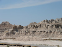 leftovers from a violent and ancient cleaving with each passing mile. Just past Kadoka, SD, route 240 marks the head of Badlands Scenic Loop. A few hours later into our trip the Badlands had become almost too much of the same thing; high, wind-carved cathedrals the color of bone. Voracious wind-- if we had stood in one spot long enough we would have been ground down, ourselves; chewed and striated by the hot harsh wind that probably killed cowboys once upon a time.
In one particular spot the limestone is the color of pink cotton candy, in another the color of a bright banana peel; the ancient sediment spun with geologic anomalies. We munched a buffalo hotdog on our drive out of the canyons.
From Badlands to Black Hills
And just as suddenly as we were overtaken by the strange Badlands, we were overcome by Black Hills. The South Dakota Black Hills are home to log cabins and cheap beef dinners. The area is thankfully unpretentious, comfortable in the visual riches they have to offer and not at all disposed to waging commercial competition for attention.
We avoided the pricey fee for going all the way into Crazy Horse, we took pictures from the road. The carving is immense, much bigger than the President’s heads on Mount Rushmore. The park fee goes toward supporting the epic carving project, but we were pretty wrung out on sight-seeing funds by the time we made it to this point. If you are interested in the history, pay the park fee and enjoy the interpretive center, otherwise there are good photo opps just outside the park gates.
South of Crazy Horse, outside Custer, SD we rented a small one-room log cabin. Owned and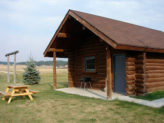 operated by a log home construction company the cabin was outfitted with all the modern conveniences. It cost us just over $100 for the night, less than a decent hotel and it was loaded with character, not to mention the perfect ambience in which to experience the South Dakota wilderness. If we had had more time we would have stayed longer and used the outdoor fire ring and fishing hole and spent an evening taking in the light show of a wide open night sky.
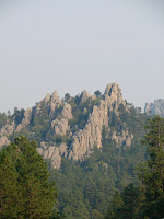 Our best driving tip of the trip was for Needles Scenic drive- a two to three hour drive through the best hidden twists and turns of the Black Hills. The drive, we cut it short by taking a short cut, really offers the best views of notable Black Hills peaks: Cathedral Spires and the Needles, both dramatic upright spikes of granite that scream ancient earth movement, looking thrust upright in a violent once-upon-a-time collision of tectonic plates or glacial tsunami. You can find Needles Drive not far from Crazy Horse. Follow routes 16A and 87. If you have a detailed map you can also cut the drive short if you need to; we did.
Our other “best of” recommendation was the dinner tip. In little downtown Hill City, just north of Custer, the Alpine Inn delivers a rare specialty: filet mignon dinner with all the trappings for $9.95 (no, not a typo). You can choose a smaller filet for $7.95, but we were hungry and totally taking advantage of the opportunity. Our total bill (for two) came to just under $30 and that with a glass of wine each added to the special. Do not expect options. This is the meal they serve every night, all year long.
Head West, young woman and man.
I really have a thing against those headline articles entitled "X, A Best Kept Secret" because, duh, now it's no longer a best kept secret and who the hell would want to go there with the throngs of newbies hatched from that high profile article? So why did I name a SD roadtrip a best kept secret? Number one--it is still a minority that will actually have the gusto to take on the long-distance tar--if you do, kudos and may the road rise to meet you, you'll not be disappointed. And South Dakota is one of those states that many Americans could say, "Now where is South Dakota again? It's up near the Great Lakes or near California, isn't it?" It truly is a best kept secret. Here's my impression of southern South Dakota if I can inspire you to secretly getaway from it all...
South Dakota for me was an unexpected surprise and cacophony of variations. One minute there was epic expanse of waning sunflowers-- acres and acres of them as far as I could see-- then just as suddenly leagues of open range, the color and texture of suede; beyond those were pockets of mustang ranches.
Alongside I-90, at mile marker 139, over some no-name hillock the earth splits in an open crevice, then a few small crevasses, very subtle at first, if open gashes in the surface of a skin could be considered subtle. Each chasm is that much more significant,
 leftovers from a violent and ancient cleaving with each passing mile. Just past Kadoka, SD, route 240 marks the head of Badlands Scenic Loop. A few hours later into our trip the Badlands had become almost too much of the same thing; high, wind-carved cathedrals the color of bone. Voracious wind-- if we had stood in one spot long enough we would have been ground down, ourselves; chewed and striated by the hot harsh wind that probably killed cowboys once upon a time.
In one particular spot the limestone is the color of pink cotton candy, in another the color of a bright banana peel; the ancient sediment spun with geologic anomalies. We munched a buffalo hotdog on our drive out of the canyons.
From Badlands to Black Hills
And just as suddenly as we were overtaken by the strange Badlands, we were overcome by Black Hills. The South Dakota Black Hills are home to log cabins and cheap beef dinners. The area is thankfully unpretentious, comfortable in the visual riches they have to offer and not at all disposed to waging commercial competition for attention.
We avoided the pricey fee for going all the way into Crazy Horse, we took pictures from the road. The carving is immense, much bigger than the President’s heads on Mount Rushmore. The park fee goes toward supporting the epic carving project, but we were pretty wrung out on sight-seeing funds by the time we made it to this point. If you are interested in the history, pay the park fee and enjoy the interpretive center, otherwise there are good photo opps just outside the park gates.
South of Crazy Horse, outside Custer, SD we rented a small one-room log cabin. Owned and
 operated by a log home construction company the cabin was outfitted with all the modern conveniences. It cost us just over $100 for the night, less than a decent hotel and it was loaded with character, not to mention the perfect ambience in which to experience the South Dakota wilderness. If we had had more time we would have stayed longer and used the outdoor fire ring and fishing hole and spent an evening taking in the light show of a wide open night sky.
 Our best driving tip of the trip was for Needles Scenic drive- a two to three hour drive through the best hidden twists and turns of the Black Hills. The drive, we cut it short by taking a short cut, really offers the best views of notable Black Hills peaks: Cathedral Spires and the Needles, both dramatic upright spikes of granite that scream ancient earth movement, looking thrust upright in a violent once-upon-a-time collision of tectonic plates or glacial tsunami. You can find Needles Drive not far from Crazy Horse. Follow routes 16A and 87. If you have a detailed map you can also cut the drive short if you need to; we did.
Our other “best of” recommendation was the dinner tip. In little downtown Hill City, just north of Custer, the Alpine Inn delivers a rare specialty: filet mignon dinner with all the trappings for $9.95 (no, not a typo). You can choose a smaller filet for $7.95, but we were hungry and totally taking advantage of the opportunity. Our total bill (for two) came to just under $30 and that with a glass of wine each added to the special. Do not expect options. This is the meal they serve every night, all year long.
Head West, young woman and man.
Thursday, February 21, 2008
Driving I-95 from Richmond to New York and Boston
Interstate 95 along the eastern corridor, particularly that stretch of tar between Richmond Virginia and Boston (the Megalopolis), has earned a reputation as a treacherous drive. Despite its teeth, millions of travelers hit this roadway everyday. I've been among them at various times of the year over the last 15 years. I've tackled 95 during rain and snow, during daylight hours, during nighttime, summer, winter, spring and fall, and holidays, weekends and weekdays.
I've found the absolute best time to challenge I-95 between Richmond and New York City, either north or southbound, is during the middle of the night. Again after years of being stung by traffic jams, bottlenecks and absurd congestion I far prefer this alternative. Nighttime driving along 95 is no desolate drive, you'll be surprised how many travelers opt for this time of day to make the pilgrimage north or south along infamous I-95. Rest areas are well lit and travelers are moving about.
Rest Areas and Full Service Travel Centers: In Maryland (Chesapeake House and Maryland House) and along the Jersey Turnpike the service centers are open, though many of the restaurants in them shut down around midnight. Although I was surprised this past Christmas to find a Starbucks open in a New Jersey travel center. Apparently they do this on the weekends--stay open later possibly even all night. You'll even find that many of the full service tourist centers have added WiFi services, so if you need to log on to your laptop you'll have little problem finding a hotspot.
You'll find that the major metro regions -- Baltimore and DC I'm thinking of particularly-- provide beltways around the areas and once upon a time I would have opted to drive those, but in recent years I've discovered that I have less traffic jams when I just follow I-95 signs straight through. In Baltimore this means you follow the highway through the Fort McHenry Tunnel that literally puts you underneath Baltimore Harbor. In New York City straight along I-95 carries you up and over the George Washington Bridge. Traveling southbound you'll get a view of the NYC skyline if you glance to your left; northbound you'll glance right. Beware: I've nearly be sideswiped taking in the skyline at night with a carefree glance. I reiterate: there is still a significant traffic volume through the major metro areas even at midnight and later.
How to drive on I-95: When you hit New York City and New Jersey yu better be alert and ready to drive with a mix of defensiveness and aggressiveness. Especially passing through NYC I-95 lanes are narrow and rough, concrete barriers allow little leeway for mistakes and you pass literally up underneath the city, lots of very tight, dark and rutted underpasses and drivers are confident and even aggressive--you must be a sure-footed driver. I actually consider this type of driving not unlike a sporting event--long-distance driving is not to be taken lightly and you really msut be mentally and physically prepared. Sound silly? Not if you've ever done this drive alone and in the middle of night. I've been nearly purposely run off the road by a trucker, I've seen a car in front of me have a major tire blow, I've been a passenger when a flatbed truck lost a stack of huge tires into our travel lane, and I've seen a car come sailing over a concrete barrier from opposing lanes and land behind me in oncoming traffic. Be alert and ready for anything.
Tolls: This stretch of I-95 is dotted with tolls. Northbound travelers pay more than southbound--no charge for GWBridge southbound. I think my latest calculations put a northbound toll total at around $27 between Richmond and NYC, so make sure you have cash. Frequent travelers along this route have E-Z Passes and you'll have to pay extra attention when coming up on the toll centers--some lanes are reserved for E-Z Pass holders only and do not take cash--so look for cash or combo lanes. And pay close attention to the traffic merges when coming out of the booths--where lanes have expanded for tolls they do the inverse--you'll lose lanes quickly and discover you merge with really fast moving traffic really quickly if you're not watching the road ahead.
Resources for Driving I-95:
Outside of a good road map a few other relevant resources include the NJ Turnpike Authority. The Visitors section of the NJTA website provides maps, traffic conditions and locations for service centers.
The Maryland Dept of Transportation website is ugly and not user-friendly so I'm not linking to it--useless unless you'd like to pick through PDF files and miniscule font. This needs a serious update!
Virginia DOT provides a pretty good index of links to a wide range of travel info that may help getting along the I-95 corridor in VA.
happy trails.
Buy a Road Map that Works
In the beginning there were no maps. Explorers set out to survey, sketch, and otherwise render their world. But we no longer have to set out with compass and survey equipment and pack animals. I criss-crossed the U.S. by car in 2007 with a travel nurse and a cat. Our most critical travel item was our road map. It is not one of those dinky ones, no abridged version. It features big pages full of state maps and accompanying pages with blow-ups of major metro areas (a critical feature). It also highlights national and state parks and makes a pretty accurate attempt to even show the actual exit numbers on the major highways.
For a road map with all that plus- you should shop for the ones that offer abbreviated state guides, trivia, and especially interesting the lists of must-see sites and places to eat in each state.
For a road map with all that plus- you should shop for the ones that offer abbreviated state guides, trivia, and especially interesting the lists of must-see sites and places to eat in each state.
Subscribe to:
Posts (Atom)